Drone Waypoint Missions Explained: Plan Automated Flights Like a Pro

- Primary Signal: Drone Waypoint Missions Explained: Plan Automated Flights Like a Pro
- Overview: Waypoint missions let your drone fly a planned route by itself while you concentrate on the camera. Here is how they work, what they are good for, and the safety rules that apply....
- Verification: Analyzed and compiled by FreeSky Aerial editorial monitoring desk.
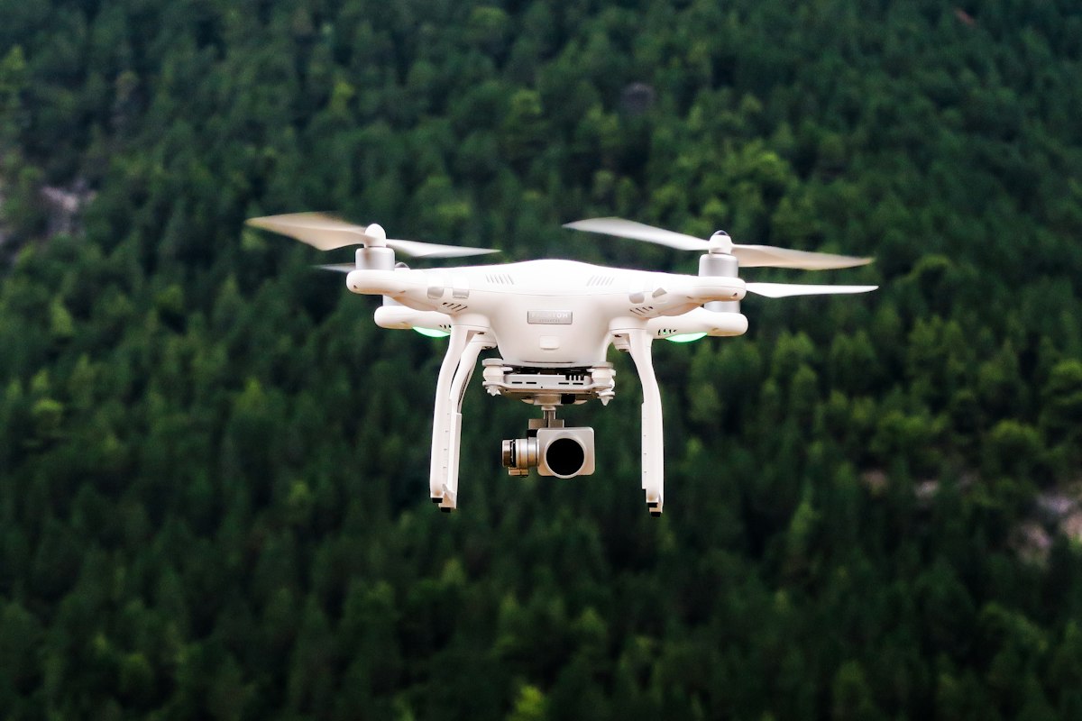
A waypoint mission is a flight you plan on a map before take-off: a series of points, each with an altitude, a speed, and a camera action, that the drone then flies by itself. The pilot's job changes completely — instead of steering, you watch the shot, adjust the camera, and stay ready to take over. Waypoints are how professionals get repeatable, cinematic shots: the same smooth orbit, the same rising reveal, the same mapping grid, flown identically every time. They are also one of the most useful features a recreational pilot never tries, because the setup looks more complicated than it is.
How Waypoint Missions Work
You create a mission in the flight app or on a computer: tap points on a map to lay out the route, set the altitude and speed for each segment, and assign camera actions such as taking a photo, starting video, or pointing the camera at a point of interest. The app shows the total distance and estimated flight time, and warns you if any leg exceeds the battery you have left. Once you launch, the drone flies the route autonomously, following the plan while you monitor it — and you can pause, resume, or take manual control at any moment.
Modern drones add refinements that make missions far more useful than a simple connect-the-dots route. Points of interest let the camera track a subject automatically while the drone moves. Curved turns smooth the corners so the footage does not jerk at each waypoint. And repeatable missions let you save a route and fly it again days or weeks later, which is invaluable for construction progress, seasonal comparison, or a shot you want to reshoot in better light. Some apps also support terrain following, adjusting altitude to the ground below rather than holding a fixed height above the take-off point — essential in hilly country.
What Waypoint Missions Are Good For
Cinematic video is the most obvious use. A planned route produces smooth, repeatable camera moves that are nearly impossible to fly by hand: a slow orbit around a building, a rising reveal over a ridge, a tracking shot along a coastline. Mapping and surveying is the second major use — a grid pattern flown at a fixed altitude with overlapping photos, which software stitches into a map or a 3D model. Real estate, agriculture, and construction all use this pattern daily, and the same technique works for a personal project like mapping a farm or a large property.
Inspection work is the third use: a mission that visits the same points on a roof, a tower, or a bridge on a regular schedule, producing comparable photos each time so changes are easy to spot. And for beginners, waypoints are a learning tool — planning a route forces you to think about airspace, obstacles, and battery before take-off, which is exactly the discipline that makes a good pilot. A mission planned carefully on the ground is almost always safer than a flight improvised in the air.
The Safety Rules You Cannot Skip
Automation does not remove responsibility. You must keep the drone within visual line of sight throughout the mission, even though you are not steering it — if you cannot see it, you cannot react to a problem. Check the route against airspace restrictions before launching, and walk the route mentally for obstacles the map does not show: trees, wires, and buildings that grew since the satellite image was taken. Set the return-to-home altitude above the tallest obstacle on the route, and keep enough battery in reserve to complete the mission and return — a mission that uses ninety percent of the battery leaves no margin for wind or a delayed landing.
Finally, test new missions somewhere open and forgiving before flying them somewhere that matters. A first run over an empty field reveals the mistakes in your plan — a waypoint too low, a turn too tight, a speed too fast — without consequences. Waypoint flying rewards preparation and punishes improvisation, and the pilots who get the best results are the ones who treat the planning as the real flying.
Frequently Asked Questions
Q: Can any drone fly waypoint missions?
A: Most modern camera drones support them, either natively or through the manufacturer's app. Very small toy drones and some entry-level models do not.
Q: Is it legal to fly a drone on autopilot?
A: In most countries, yes, as long as you keep the drone within visual line of sight and stay ready to take manual control. Fully autonomous flight beyond line of sight needs special permission.
Q: What happens if the drone loses signal during a mission?
A: It normally continues the mission or returns home, depending on your failsafe settings. Check those settings before every mission — they are the difference between a recovery and a loss.
📖 Continue Reading the Full Story
Continue reading this article on FreeSky Aerial.
⚡ Access Full Content NowMore from FreeSky Aerial

 ☁️ FreeSky Cloud
The 30-Day Mastery Plan: Pakistan Board Exam Calculator — Matric & FSc Percentage, Grade & Merit (Day 30 Guide)
Level up your daily workflow with the Pakistan Board Exam Calculator — Matric & FSc Percentage, Grade & Merit ...
 🔭 FreeSky Cosmos
What Planets Are Visible Tonight in November 2026? A Simple Evening and Morning Guide
Saturn rules the evening sky while Venus, Jupiter and Mars greet early risers in November 2026 — here is exact...
 ⚡ CyberTech 568
Step-by-Step Tutorial: Playback Speed Calculator — Video Time at Any Speed (Day 2 Guide)
How to accurately use the Playback Speed Calculator — Video Time at Any Speed on CyberTech 568. Discover essen...
🤖 WinBar AI
Step-by-Step Tutorial: YouTube Thumbnail Downloader & Grabber — 4K (Day 2 Guide)
How to accurately use the YouTube Thumbnail Downloader & Grabber — 4K on WinBar AI. Discover essential practic...